Trækstien between Silkeborg and Randers - 70 km
The towpath along the Gudenåen River is the ideal hiking route for those who dream of getting close to nature. At around 70 kilometres, the trail winds its way from Silkeborg to Randers and offers unique nature experiences through the charming landscape of river valleys, forests and open fields.
The Bargermans Path, Trækstien trail, takes you close to the calm waters of Gudenåen - in fact, closer than ever before. The historic route follows the meandering course of the river, revealing new views and experiences with every step. Quiet forest stretches, open meadows, rich birdlife and idyllic waterside breaks await.
Whether you're looking for a day trip or a longer walking holiday, Trækstien invites you to immerse yourself in the peace and beauty of nature. The route is suitable for both experienced hikers and nature lovers who want to get away from the daily grind and into the great outdoors. The Trækstien trail, which follows the Gudenå River from Silkeborg to Randers, is approximately 70 kilometres in total.
Unique nature along the old Træksti trail
Trækstien, also known as Bargermans Path along Gudenåen, takes you on a historical journey where you can follow in the footsteps of horses and barge drivers. Especially in the second half of the 19th century, this path served as a lifeline, with barge dragons hauling goods on barges between Silkeborg and Randers.
The Barge Dragons and Horses on Trækstien
Historically, the trail was created for horses and bargemen, who once pulled great barges filled with goods between the two cities of Silkeborg and Randers. Barge traffic on the River Gudenå had its heyday in Silkeborg after the opening of the paper mill in 1845. Back then, it was the only way of transporting large quantities of goods to and from the city. The barges could be seen sailing on the River Gudenå right until the beginning of World War I.
Imagine the barge dragons and their faithful horses working hard to transport goods along the Gudenå River. The Towpath became their path and now you can follow the same route to understand the past, enjoy the stunning scenery and experience history.
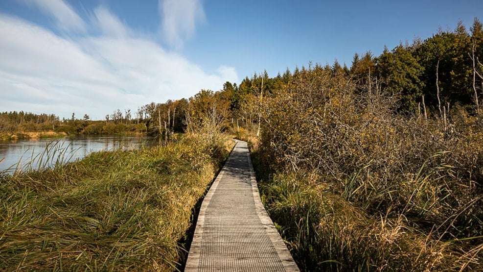
Changing terrain
The Pramdrager Trail varies significantly thanks to its proximity to the water. Some stretches have been renovated with wooden paths, while others have retained their historical heritage with muddy paths and tall grass. Before you set out, it is recommended to check the water level to customise your journey.
Please be aware that parts of the trail may be flooded due to high water levels in the River Gudenå.
The trail measures around 70 km. See maps and facilities along the trial here:
- Silkeborg - Bjerringbro (approx. 35 km)
- Bjerringbro - Randers (approx. 35 km)
- Oplevgudenaa.dk